
CubeSat Cameras Reshaping the Market of Satellite Images
There is a photograph sitting in a university lab in California. It shows a stretch of the Amazon rainforest. Nothing unusual about that — except the camera that took it weighs less than two kilograms and costs a fraction of what traditional Earth observation used to demand.
The satellite carrying it? About the size of a loaf of bread. And it was built by graduate students.
That picture remains unpublicized, but one of the more important developments in space technology history was made. A decade of development, a contract from a government, and a budget small enough to support a small country were necessary to obtain a camera into orbit for decades. Today, that equation is completely changed with a cubesat camera — and since then, the market for satellite imagery has never been the same.
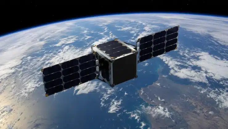
What Exactly Is a CubeSat?
Before getting into the cameras, it helps to understand the platform they fly on. A CubeSat is a miniature satellite built around a standardized unit — a 10-centimeter cube called a 1U, weighing roughly one to two kilograms. Units stack together like building blocks: a 3U CubeSat is three units long, a 6U is six, and so on.
The concept was born in 1999, proposed by professors Bob Twiggs and Jordi Puig-Suari as an educational tool. The idea was simple: let students build real spacecraft within the timeframe of a graduate degree. What nobody quite anticipated was how far beyond the classroom the idea would travel.
Do CubeSats Have Cameras?
This is one of the most common questions about these small spacecraft — and the answer is yes, increasingly capable ones.
Early CubeSat cameras were modest. Resolution was low, optics were limited by the physical constraints of a small chassis, and on-board processing barely existed. What they captured was useful for basic monitoring, but not much more.
That changed fast. A modern high-resolution cubesat camera can capture imagery at ground sampling distances between one and five meters — meaning each pixel in the image represents one to five meters of real terrain. That is sharp enough to detect changes in crop health, identify vessels on open water, spot construction activity at a remote site, or monitor the retreat of a glacier over time. The CubeSat camera resolution gap between small satellites and large traditional platforms has narrowed considerably.
What Makes a CubeSat Camera Payload Different
The challenge of designing a camera for CubeSat platforms is not just about miniaturization. It is about making every gram and every cubic centimeter count, while surviving the vibrations of launch, the thermal extremes of orbit, and years of operation without a single maintenance visit.
A typical cubesat camera payload includes the optical assembly — lenses and mirrors that focus light onto a sensor — alongside the image sensor itself, which converts light into digital data. Supporting systems handle power conditioning, thermal regulation, and data compression before the image gets sent to a ground station hundreds of kilometers below.
Some CubeSat camera modules also carry onboard processing chips that can analyze images before downlinking them. Rather than sending raw data to the ground, the satellite sends only the interesting parts — a flagged change, a detected anomaly, a confirmed location. This matters because bandwidth between a small satellite and the ground is genuinely limited, and processing in orbit saves time that would otherwise be lost waiting for a downlink window.
The Tip and Cue Approach: Working Smarter From Orbit
Here is where things get genuinely interesting. The most sophisticated operators don’t use CubeSat cameras as standalone imaging systems. They use them as scouts.
The strategy is called tip and cue. A constellation of medium-resolution cubesat camera satellites sweeps broad areas continuously — scanning forests, coastlines, shipping lanes, and agricultural regions. When something changes, the system flags it. That flag — the tip — then triggers a high-resolution asset to look closer. That follow-up is the cue.
Think of it as the difference between a wide-angle lens and a telephoto. The CubeSat constellation provides a wide view, quickly and cheaply. The high-resolution satellite provides the close-up, precisely where it is needed. Together, they achieve what neither could do alone.
This approach has become standard for monitoring illegal fishing, detecting early deforestation, tracking wildfires before they spread, and watching infrastructure changes at remote sites. The cubesat camera network does the searching. The expensive assets do the confirming.
Why the Market Exploded
The satellite imagery market was once small, expensive, and dominated by a handful of suppliers. That description no longer applies.
CubeSats compressed the cost of getting a camera into orbit from hundreds of millions to hundreds of thousands of dollars — sometimes less. That compression opened the market to operators who simply could not have participated before. Agricultural companies started fielding their own imaging constellations to monitor crops. Environmental agencies stopped waiting for data from shared government assets. Insurance companies began using imagery to verify claims within days of an event.
The revisit rate — how often a satellite passes over the same location — also improved dramatically. A single large satellite might revisit any given location once every few days.
What a CubeSat Camera Module Handles in the Real World
Consider a practical example. A company monitoring deforestation across a remote forest region needs to cover millions of hectares on a daily basis. A traditional high-resolution satellite is too expensive to task continuously across that area. The data volume alone would be unmanageable.
A constellation of CubeSats carrying medium-resolution CubeSat camera modules changes that picture. Each satellite scans a wide swath as it passes. Onboard processing flags pixels where vegetation cover dropped overnight. That flag gets sent to a ground station at the next downlink. By the time analysts arrive at their workstations in the morning, a shortlist of locations worth investigating is already waiting for them.
What used to require months of manual review now takes hours — and covers an area that a human field team could not survey in years.
Small Satellites, Big Consequences
The numbers behind CubeSat adoption are striking. But the more important story is not in the launch tallies or the market valuations. It is what this technology has made possible for people who never expected to have access to it.
A regional government is tracking seasonal flooding. A cooperative of farmers monitoring their fields from a central office. A researcher watches permafrost thaw across a Siberian plain. None of them could afford traditional satellite access. All of them can work with what CubeSat imagery now provides.
We think we are still in the early chapters of this shift. Camera resolution keeps improving. Onboard processing is getting faster. Constellations are growing.
What do you think the next major leap in cubesat camera technology will look like? Sharper resolution, smarter onboard AI, or something else entirely? Drop your thoughts in the comments — we would love to hear where you see this heading.